
This segment of the Great Loop is a trip through America’s heartland for more than 1,000 miles on the inland rivers. Chicago is the last big city you’ll see until you reach the Gulf of Mexico several weeks later. Many areas will be rather remote, and all but very fast boats will likely have to spend a few nights at anchor on this segment because of the lack of marinas. This segment includes the western-most point on the Great Loop as well as the longest distance between fuel stops. There are several locks along the way operated by the US Army Corp of Engineers.
This segment of the Great Loop is a trip through America’s heartland for more than 1,000 miles on the inland rivers. Chicago is the last big city you’ll see until you reach the Gulf of Mexico several weeks later. Many areas will be rather remote, and all but very fast boats will likely have to spend a few nights at anchor on this segment because of the lack of marinas. This segment includes the western-most point on the Great Loop as well as the longest distance between fuel stops. There are several locks along the way operated by the US Army Corp of Engineers.


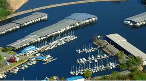
Designated the first “Clean Marina” in the State of Indiana, the Hammond Marina is just 12 nautical miles from Downtown Chicago, with a boating season that extends from May 1st until October 15th. The Marina is located on miles of sandy shoreline, and is adjacent to the Horseshoe Casino. Visitors enjoy activities that appeal to every age… all linked together by a pedestrian trail and within 2 square miles.

When leaving Chicago, there are two routes to continue your Great Loop cruise. Your route choice will depend somewhat on your boat's air draft. Route one via the Chicago River is a scenic cruise through downtown to the Chicago Sanitary and Ship Canal. There are more than 40 bridges in about 5 miles, the lowest of which has a fixed vertical clearance at 18.5 ft. If you can not clear it, then you'll take route two via the Calumet River to the Cal-Sag Channel to join the Chicago Sanitary and Ship Canal. Regardless of which route you take from Lake Michigan, you will soon come to the lowest fixed bridge on the Great Loop. At mile 300.5 on the Illinois River is a fixed railroad bridge that is charted at 19.6 feet. Sailboats that have not already done so will need to unstep their masts before leaving Chicago to clear this bridge. Transient docking is available at Big Basin Marina, just south of Juliet, IL, which provides fuel, boat repairs and a saloon to grab some grub.

Continuing downstream, there are many small towns in this area, and few facilities for docking so if the mileage is too much for one day from Havana to Grafton or St. Charles, we suggest you do an anchorage, perhaps north of the Norfolk Southern Railroad Bridge (Mile 61.6) or near the LaGrange Lock & Dam (Wicket Dam) @ Mile 80.2. The western most point on the Loop is @ Mile 61.3. You can't go wrong stopping at AGLCA Sponsor Grafton Harbor Marina. Grafton Harbor invites you to experience marina life at its finest. Whether you have a small pleasure craft or mega yacht Grafton Harbor can accommodate your needs. Floating swimming pool and hot tub, sanitary slip side pump-out, spacious gated concrete docks, Wi-Fi, satellite TV, concierge dock service and adult and family festivities are just a few of the royal amenities of Grafton Harbor. An equally great stop is Port Charles Harbor in St. Charles, MO (Upper Mississippi Mile 221.5). An AGLCA Sponsor, Port Charles Harbor offers complete harbor services includeing in water slip rental, dry docking, large fuel dock with ValvTech added to the fuel, pump-out station, ships store, newly remodeled restroom & shower facilities complete with a laundry center.

Whether you chose St. Charles or Grafton, plan on getting an early start when you leave, as there are two busy locks on the next legs and, because commercial traffic has priority when locking through, you may experience delays. Mile 0 of the Illinois River meets the Upper Mississippi River at Mile 218.0. There are several locks to contend with on this leg of the Upper Mississippi. The Mel Price Lock & Dam is at Mile 200.8. The Mississippi and Missouri Rivers converge at Mile 195.3 on the Upper Mississippi. The Chain of Rocks Lock & Dam @ Mile 185.0. St. Louis is at Mile 180.0 there are no facilities on the waterfront that allow a stop for recreational vessels. Hoppie's Marina @ Mile 158.5 is a "must-stop" because it's the last place to take on gasoline, and sometimes diesel, for about 200 miles.
On this long stretch of the Upper Mississippi, you will primarily be anchoring out overnight. Facilities for pleasure craft are few and far between. Some notables on this section of the river are: Kaskaskia Lock & Dam @ Mile 117.1 Anchorage (Rockwood Island) Mississippi River @ Mile 102.4 (56 miles from Kimmswick) Kidd Fuel Dock (diesel only, not always available, call 24 hours in advance) @ Mile 51.9 Anchorage (Little Diversion Channel) Mississippi River @ Mile 48.4 (54 miles from Rockwood Island) Anchorage (Boston Bar) Mississippi River @ Mile 7.7 (41 miles from Little Diversion) At Mile 0 on the Upper Mississippi, the Great Loop route for most Loopers takes a turn onto the Ohio River. The junction of the Ohio and Upper Mississippi Rivers is at the Ohio River Mile 981. You will now be proceeding upstream on the Ohio. Very few Loopers continue on the Lower Mississippi to New Orleans. The required fuel range is 350 miles, and there are very long stretches with no place for recreational vessels to tie up. Safe anchorages can also be hard to find due to the large amount of commercial traffic transiting the waterway. Paducah is located on the Ohio River @ Mile 934.5, which is also the junction of the Tennessee River (54 miles from Boston Bar).
This leg includes another route choice. One option is to turn onto the Tennessee River at Paducah. The Tennessee River runs from the south to the north, so keep in mind that the red buoys will now be on your right and the green will be on your left. Also, since you're on an upbound river, the right descending bank will now be on your left. Many Loopers opt to travel 12 miles farther on the Ohio to the Cumberland River to bypass a sometimes long wait on the Tennessee River at the Kentucky Lake Lock and Dam. On this route, the Cumberland River intersects the Ohio River at Kentucky Chute. Like the Tennessee River, the Cumberland is an upbound river. The Barkley Lock & Dam is at Mile 30.6 and creates Barkley Lake. Loopers will take the Barkley Canal at Mile 33 to cross into Kentucky Lake on the Tennessee River. Green Turtle Bay Marina has earned a "Must Stop!" designation by the AGLCA "Great Loopers" and is known to cruisers from the Great Lakes to the Florida waters. Green Turtle Bay has been awarded the industry coveted Five Anchor designation from Quimby's Cruising Guide. This full service marina features over 450 slips for most any boat style or size from 28' to 100', uncovered slips for both power and sail, and covered slips from 22' to 100' for cruisers and houseboats. The Marina's transient dock offers slips convenient to all amenities. They dispense ethanol-free gasoline and marine diesel, both of which are treated with Valvtect Marine additives.

This is the final leg on the Tennessee River before entering the man-made portion of the Tenn-Tom, the Divide Cut. If you plan to take a side trip on the Tennessee River to Chattanooga, you would do so during this leg. Grand Harbor Marina is located approximately 9 miles upstream of Pickwick Dam at the junction of the Tennessee River and the Tombigbee Waterway at Mile Marker 449.7. The marina features covered slips from 24' through 70’ and transient dockage. Each of the more than 325 slips are protected by an 8-foot breakwater and backed by all of the top notch facilities you would expect to find at the ultimate marina resort. With pump out stations, electric service (50 amp 220v and 30 amp 125v) and a fuel dock equipped with high-speed pumps for diesel Grand Harbor is the ideal refueling point for boats and their crew.

Grand Harbor is at the entrance to the Divide Cut which marks the beginning of the man-made canal that connects the Tennessee River with the Tombigbee River. It is a straight, man-made canal built by the Corp of Engineers that was opened in 1985, making possible this popular Great Loop route that avoids the lower Mississippi. From the Tennessee River, turn into Yellow Creek at the Mississippi/Tennessee state border. On your way to Fulton, you will encounter three locks, Whitten Lock @ mile 411.9, Montgomery Lock @ mile 406.7, Rankin Lock @ mile 398.4. Fulton is at Mile 392.

This leg includes several locks, the first of which you'll quickly encounter after departing Fulton. Fulton Lock is @ Mile 391.0, Glover Wilkins Lock is @ Mile 376.3, Amory Lock & Dam is @ Mile 371.1, Aberdeen Lock and Dam is @ Mile 357.5, John Stennis Lock and Dam is @ Mile 334.7. A possible end to this leg is Columbus, MS at Mile 335.
More locks in store as you depart Columbus, including the Tom Bevill Local at Mile 306.8 and the Howell Heflin Lock at Mile 266. The White Cliffs of Epps are a scenic area of the waterway at Mile 249. Most Loopers will include an overnight stop at an anchorage during this leg. A possible anchorage is at the Cochran Cutoff at Mile 287.3. Demopolis, at Mile 216.7, is your next opportunity to tie up at a marina.
Shortly after leaving Demopolis you will reach the Demopolis Lock & Dam at Mile 213.3. This is another leg that will require an overnight anchorage for most Loopers. One option is Bashi Creek at Mile 145. Coffeeville, at Mile 118.9 is the location of Bobby's Fish Camp which offers the opportunity to tie up for the night and take on fuel.

This final leg of the inland rivers includes the Coffeeville Lock & Dam at Mile 116.6. You will also find that the waterways as you proceed south become tidal. If the trip from Coffeeville to Mobile Bay is more than you care to do in one day, a possible anchorage is found at Three Rivers Lake (Mile 63.0). Arriving in Mobile Bay marks a mile stone as you complete your trip on the inland rivers. There are plenty of opportunities to provision and prepare for your Gulf Crossing. There are several AGLCA Sponsor marinas to visit on Mobile Bay. At Dog River Marina, a Looper favorite, they have 90 slips; 80 of these are sheltered. All are located on their 14 acre facility. Dog River Marina Complex is a full service marine facility. Their service repair facility is staffed with highly trained personnel to handle everything from simple repairs to complete overhauls. Across Dog River is another Looper favorite, Turner Marine Supply. Turner Marina is a 12 acre marina/sales/repair facility that has been providing the best value in services to the boating public for 50 years. They have a 50 Ton travelift with an inside clearance of 23' which allows them to haul most vessels for repair and maintenance by their on-site techs who specialize in mechanical, electronics, rigging, cabinetry, and all fiberglass and painting applications from the smallest bay boat to large offshore cruisers. If the eastern shore of Mobile Bay is your destination, don’t miss Eastern Shore Marina in Fairhope. A full service boatyard on Fly Creek across from the Fairhope Yacht Club and Sunset Point Restaurant, Eastern Shore includes a fuel dock with quantity discounts on gas and diesel, marine supplies, mechanical, electrical, fiberglass, carpentry, rigging and painting staff on-site. They also feature a laundromat and shower facilities, a well-marked channel, and transient dockage to 90 feet. Within minutes from the marina are specialty shops, pubs, restaurants, groceries, and rental cars. A courtesy van is available on-site.


